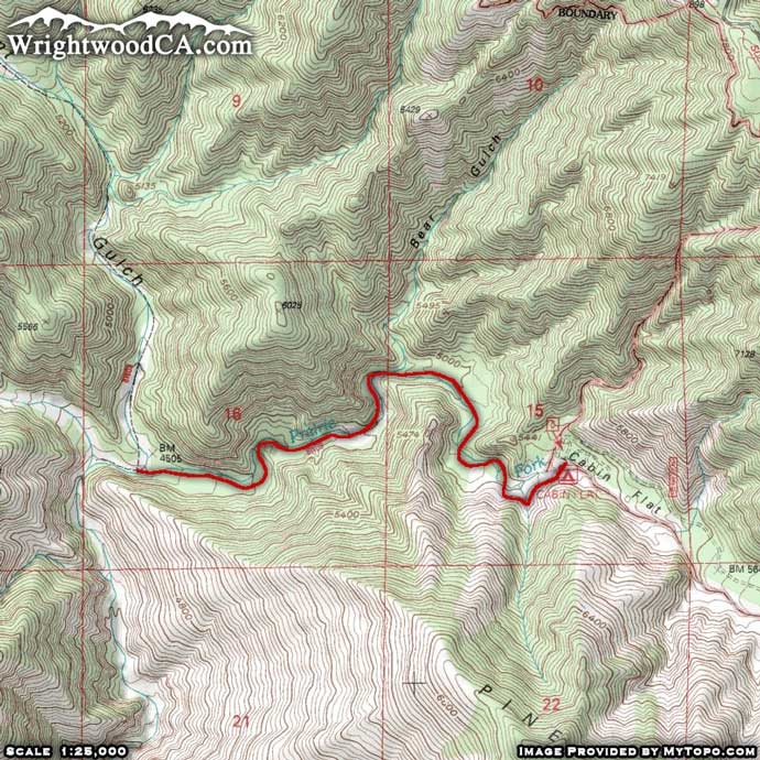
Prairie Fork Trail
Hiking Trails
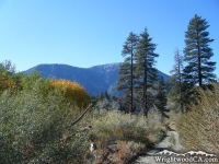 View Photos (6) View Photos (6)
|
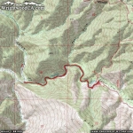 View Maps (2) View Maps (2)
|
Prairie Fork Trail Information |
| Length: | 2.4 miles |
| Type: | One Way |
| Gain/Loss: | +/-800' |
| Difficulty: | Moderate |
| Trailhead: | Cabin Flats Campground |
| Location: | South of Wrightwood |
|
Prairie Fork Trail Elevation Profile
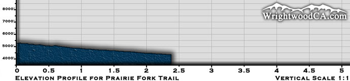
*Elevation data provided by National Geographic Topo!*
Prairie Fork Trail Description
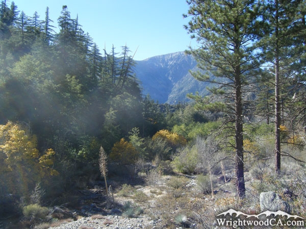
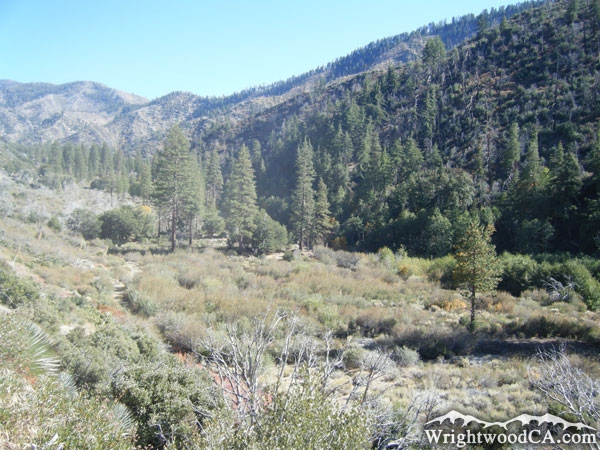
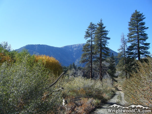
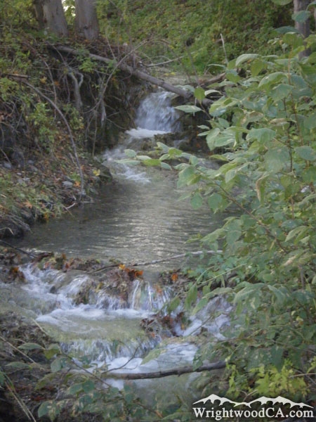
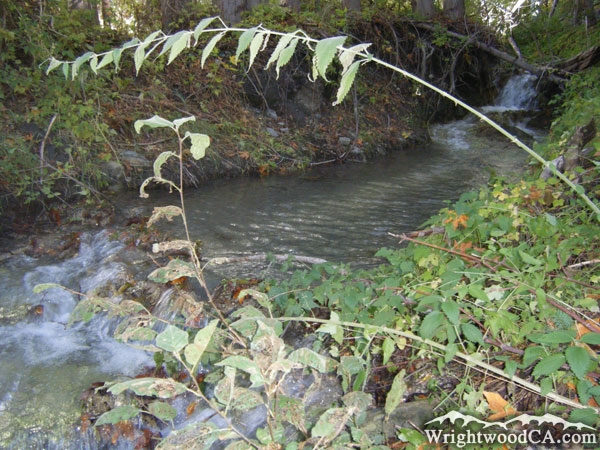
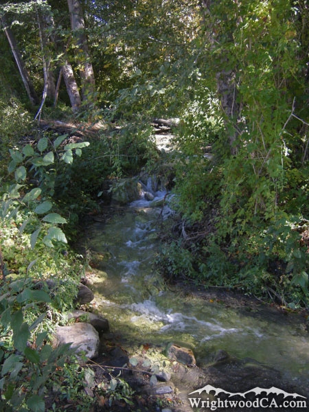
The Prairie Fork Trail is located south of the town of Wrightwood, in the Prairie Fork. The trail actually starts in Cabin Flat Campground, which is difficult to access in itself. From Cabin Flat Campground, the trail runs along the south side of Prairie Fork west, then south as the canyon turns. Toward the start of the trail, the maintenance isn't terrible, however it is sometimes difficult to follow. By the time the canyon begins turning, it is nearly impossible to follow the trail as it is severely overgrown. Like the Dawson Peak Trail, wearing long pants or other leg protection is necessary for this hike. Ultimately the "trail" dumps you into the San Gabriel River Basin (East Fork) and connects with the Mine Gulch Trail.
Directions to Prairie Fork Trail from Wrightwood
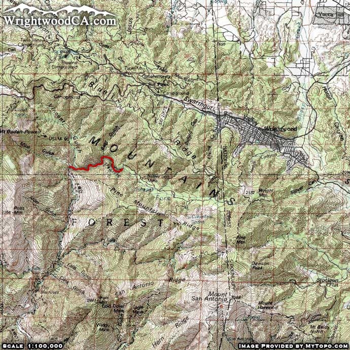
Take Highway 2 westbound from the town of Wrightwood to Inspiration Point. From Inspiration Point, take Blue Ridge Road past Blue Ridge Campground to the Guffy Campground split. Take the lower road down into Prairie Fork to Lupine Campground. You can park your vehicle here (with a National Forest Adventure Pass displayed in the windshield of your vehicle) and hike down to Cabin Flat Campground for the trail head of the Prairie Fork Trail. Another option would be to take Highway 2 from Inspiration Point down to Vincent Gap. Hike the Mine Gulch Trail down to its intersection with the Prairie Fork Trail (deep in the San Gabriel River Basin (East Fork).
Prairie Fork Trail Photos
Prairie Fork Trail Maps
|