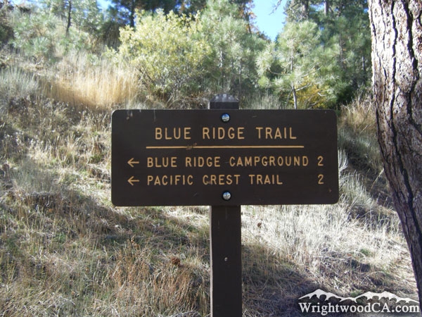
Wrightwood CA
Wrightwood CA Weather, webcams, cabins, hotels and more... Elevation: 6,000' Population: 4,525


Replace this Google Ad with your own Advertisement for only $200 per month and be seen on EVERY page!

Blue Ridge Trail


Hiking Trails

Blue Ridge Trail - Wrightwood CA HikingView Photos (18) Map of Blue Ridge Trail - Wrightwood CA HikingView Maps (2)

Blue Ridge Trail Information

Length: 2.0 miles
Type: One Way
Gain/Loss: +/-1050'
Difficulty: Moderate
Trailhead: Big Pines / Blue Ridge Campground
Location: West of Wrightwood

Blue Ridge Trail Elevation Profile

Blue Ridge Trail Elevation Profile

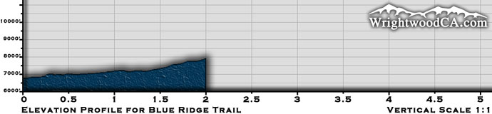
*Elevation data provided by National Geographic Topo!*


Blue Ridge Trail Description

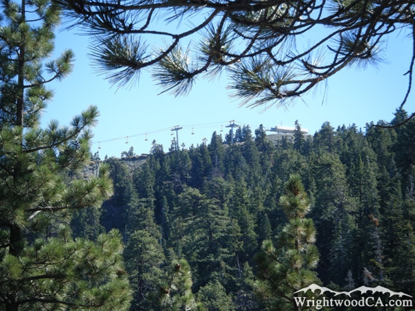
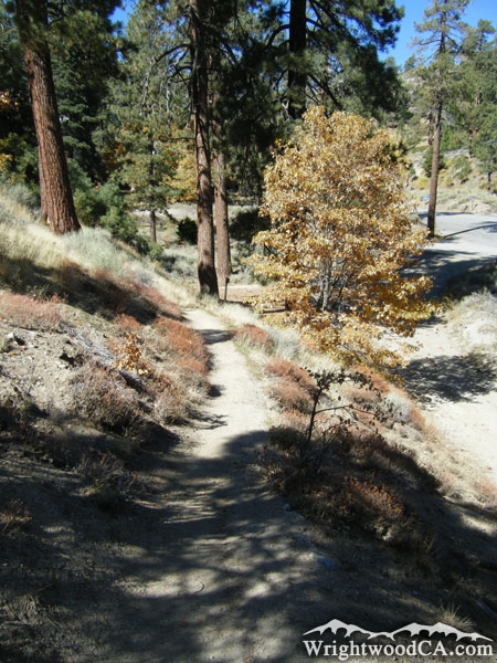
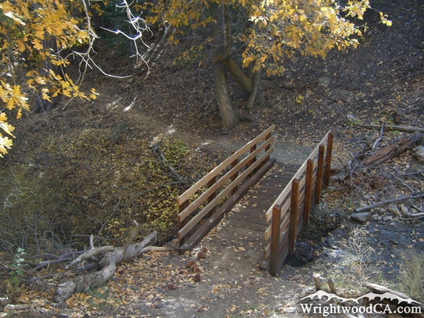
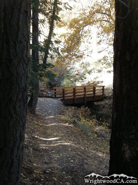
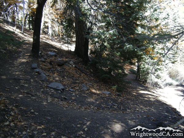
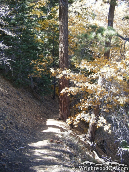
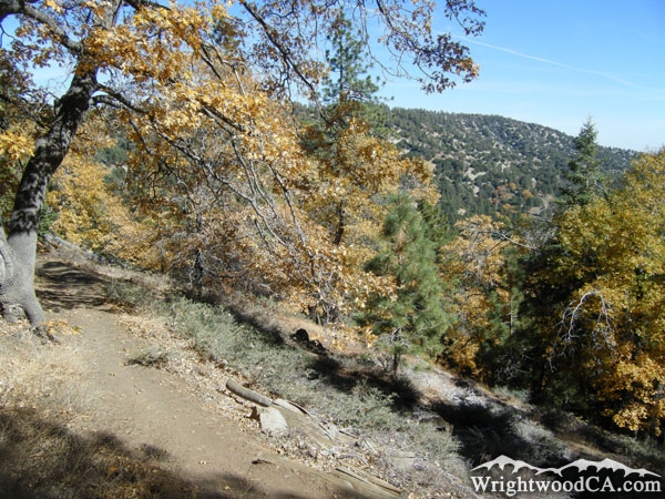
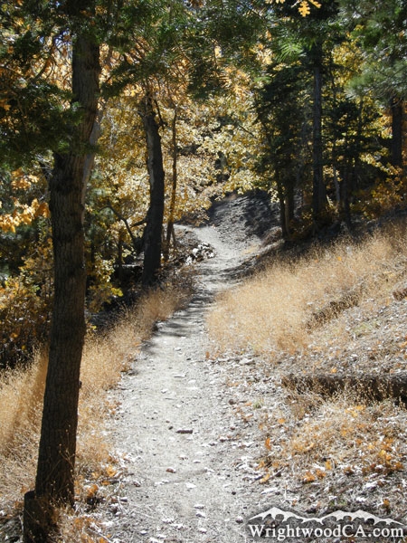
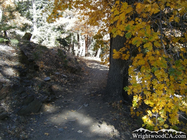
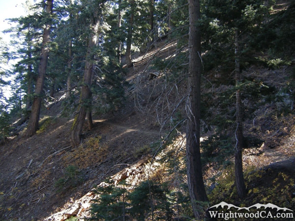
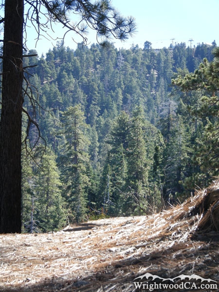
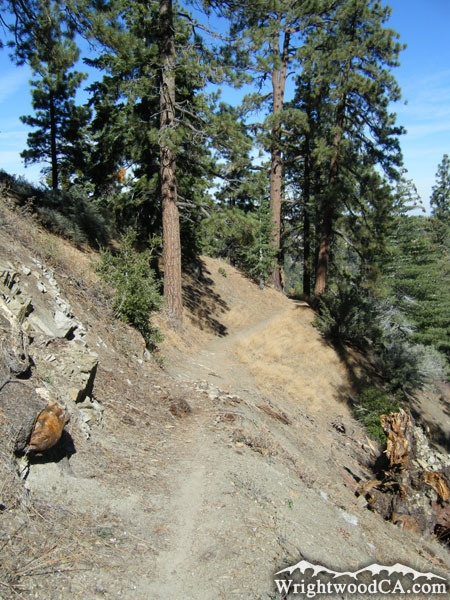
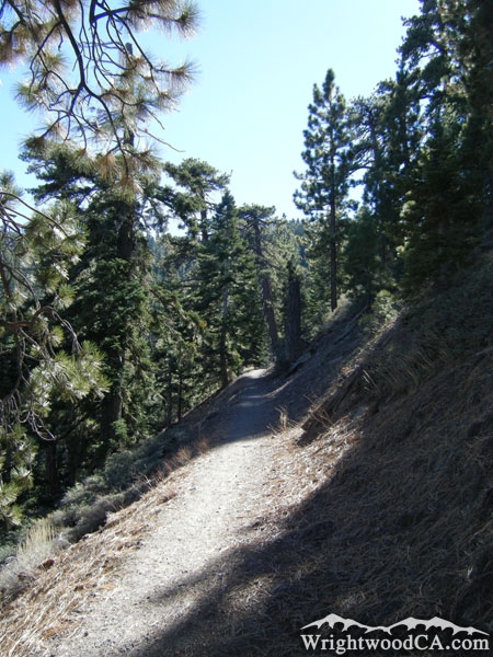
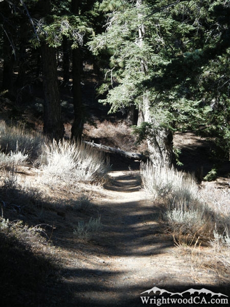
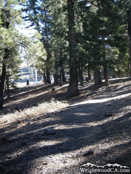
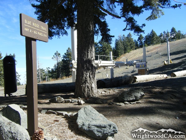
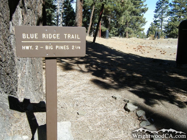
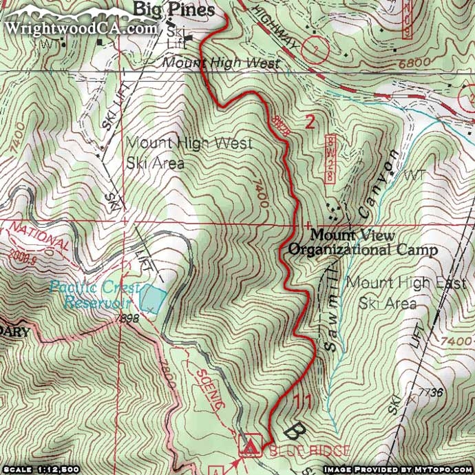
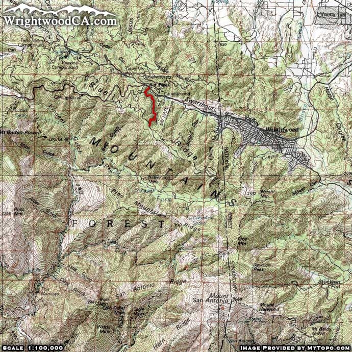
The Blue Ridge Trail is located west of the town of Wrightwood, near the exit of the Mt High West parking lot in the Big Pines area. The trail starts off by crossing a wood bridge over a creek filled with the runoff of melting snow from Mountain High. You then traverse up the side of Blue Ridge through oak trees, then later pine trees. Toward the top of the hike you can see the chair lifts going up Mountain High's East Resort. At the end of the trail is the Blue Ridge Campground. Overall, this trail isn't terribly difficult (easier than the Acorn Trail), and it is under the shade of trees almost the whole time. The Blue Ridge Trail is definitely one of the more pleasant hikes in the Wrightwood area.

Directions to Blue Ridge Trail from Wrightwood

From Wrightwood, take Hwy 2 westbound, approximately 1 mile past Mountain High's East Resort, to the Big Pines Visitor Center. The trail head is located on the south side of Hwy 2, at the bottom of the exit road to Mountain High's West Resort.

Don't forget to display a National Forest Adventure Pass in the windshield of your vehicle.

Blue Ridge Trail Photos

Ski lifts at Mountain High East viewed from the Blue Ridge Trail - Wrightwood CA HikingTrail head to Blue Ridge Trail at Big Pines - Wrightwood CA HikingBlue Ridge Trail - Wrightwood CA HikingBridge over a creek of runoff water from Mountain High
Bridge Blue Ridge Trail - Wrightwood CA HikingBlue Ridge Trail - Wrightwood CA HikingBlue Ridge Trail - Wrightwood CA HikingBlue Ridge Trail - Wrightwood CA Hiking
Blue Ridge Trail - Wrightwood CA HikingBlue Ridge Trail - Wrightwood CA HikingBlue Ridge Trail - Wrightwood CA HikingBlue Ridge Trail - Wrightwood CA Hiking
Climbing the hillside on Blue Ridge Trail - Wrightwood CA HikingBlue Ridge Trail - Wrightwood CA HikingBlue Ridge Trail - Wrightwood CA HikingNear the top of the Blue Ridge Trail - Wrightwood CA Hiking
Blue Ridge Trail head from Blue Ridge Campground, next to Mt High East Resort - Wrightwood CA HikingTrail head to Blue Ridge Trail from Blue Ridge Campground - Wrightwood CA Hiking

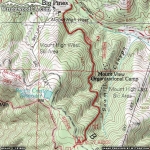
Blue Ridge Trail Maps

Blue Ridge Trail Map - Wrightwood CA HikingBlue Ridge Trail Area Map - Wrightwood CA Hiking


Replace the Google Ad at the top of this page with your own Advertisement for only $200 per month and be seen on EVERY page!

Copyright © 2011-2023 WrightwoodCA.com - All Rights Reserved.
Paid Banner Advertising | Premium Business Listing Service

Wrightwood CA Info: About The Town | Business Directory | Live Webcams | Photo Gallery | Video Archive | Emergency Resources | Maps and Directions | Mountain Road Conditions | Homes and Real Estate | Lodging, Cabins & Hotels | Organizational Camps | Local Campgrounds | Snow Playing | Skiing & Snowboarding | Ziplines at Pacific Crest | Event Facilities | Hiking Trails | San Gabriel Mountains | Canyons and Valleys | Picnic Areas | Visitor Centers